RaterKit
The app that handles the calculations of a USGA™ Course Rating survey, freeing raters to evaluate the course.
A day on the course, an afternoon typing
A rating team heads out onto the course with stacks of printed rating forms and the manual in the bag. It takes an entire day, sometimes more. Hole by hole, they measure, evaluate every obstacle, and record values by hand—often copying the exact same measurement over and over again.
Then comes transcription. Someone transfers those paper sheets into the association's Excel™ workbook. From there, data is entered into the USGA™ calculation tool to generate final ratings. Until now, the only tool taken onto the course was paper.
How many values a course carries
One survey form covers one tee and one gender, with a scratch column and a bogey column per hole. The three figures are approximate and come from a real form; the whole count is in the blog.
-
The traditional survey, on paper
3,300values written by hand. Almost 600 are a hole fact copied from one form to the next, and some 1,900 are reads off the manual's tables. -
In the app, nothing traced
1,150values typed in with the same tape and the same rangefinder. The app reads the tables and the hole facts are entered once. -
In the app, the course traced
100values entered on the course, between the GPS points and what only an instrument gives. Plus some 115 elements traced once over the satellite image.
What changes in the day
The team is still on the course for the whole day. What changes is how much is already measured before they go out, how much the app derives, and how much is left to type on the way back.
The associations that publish their times count up to two hours of administration for every set of tees surveyed. A good part of it is typing the paper into the spreadsheet, and that step goes away.
-
Stays the same
The team walks the course, rates every obstacle and signs what it hands in.
-
Measured beforehand
Yardages, carries, and the landing zones for every tee, every gender and every skill, all on the tracing.
-
Disappears
Typing the paper into the spreadsheet, and looking each value up in the manual's tables.
One hole, from the tracing to the form
Key screens from the app walking through a real hole from start to finish. The rater maps it out before heading out (or right on the course), walks it during the survey, and exports the completed form at the end.
On the tracing
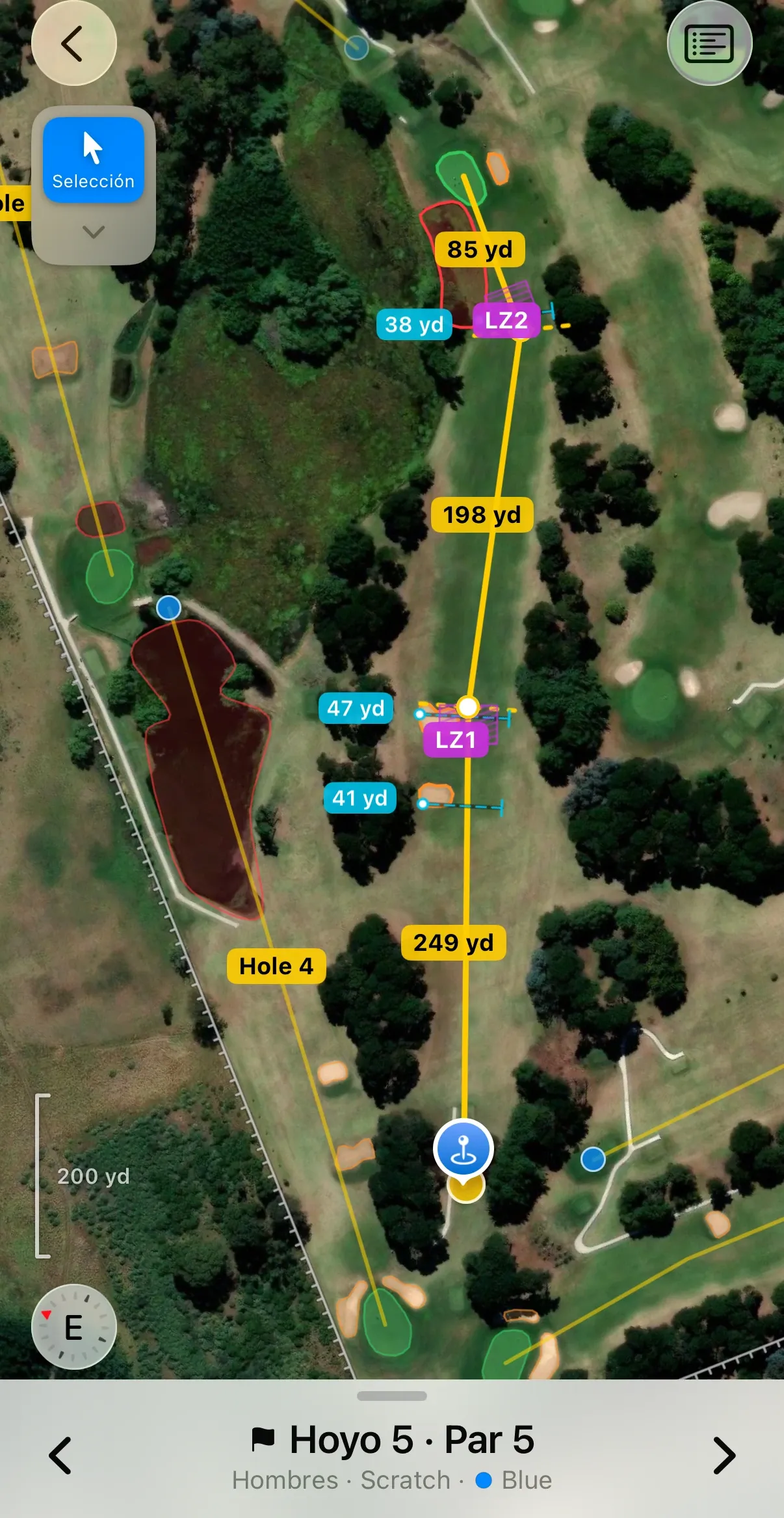
The rater traces the hole before going out
Before setting out (or standing directly on the course), the rater starts tracing the hole. The tee, green, and line of play form the core structure; bunkers, penalty areas, and features enrich the map. Every point placed is a coordinate, and all subsequent derivations flow from it.
On the tracing
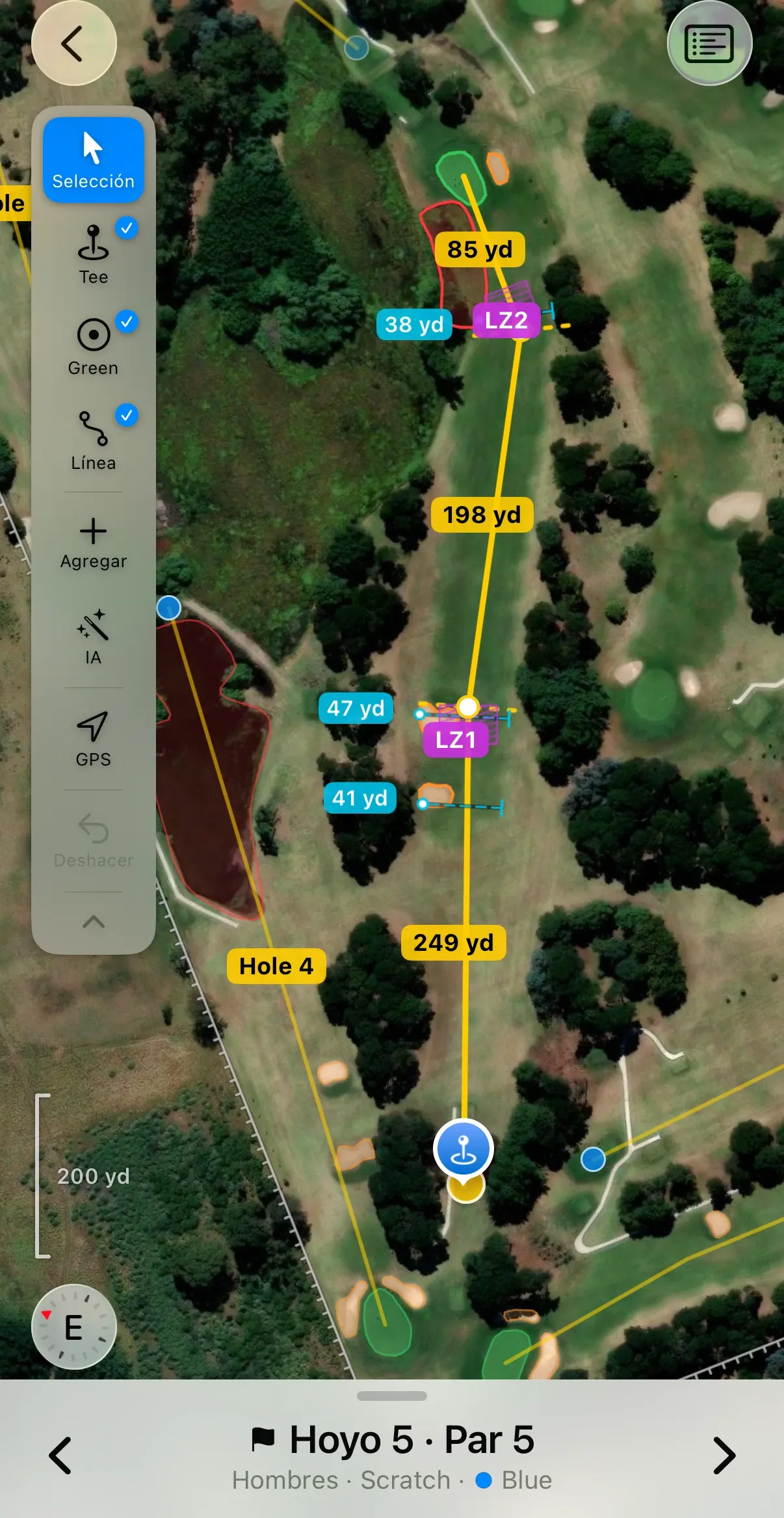
The landing zones appear on their own
With the tee, green, and line of play set, the app calculates where each shot lands according to rating tables and marks landing zones over the imagery. The rater can place a measurement ruler across any landing zone to gauge fairway width; the app reads it and stores the value for the form.
On the course
Standing on the tee, the rater anchors it
Out on the course, the rater can calibrate the position of anything traced with the precision of GPS. The app says how far the correction moved it from what the map measured. Once defined, that value is recorded with the source that calibrated it.
On the course
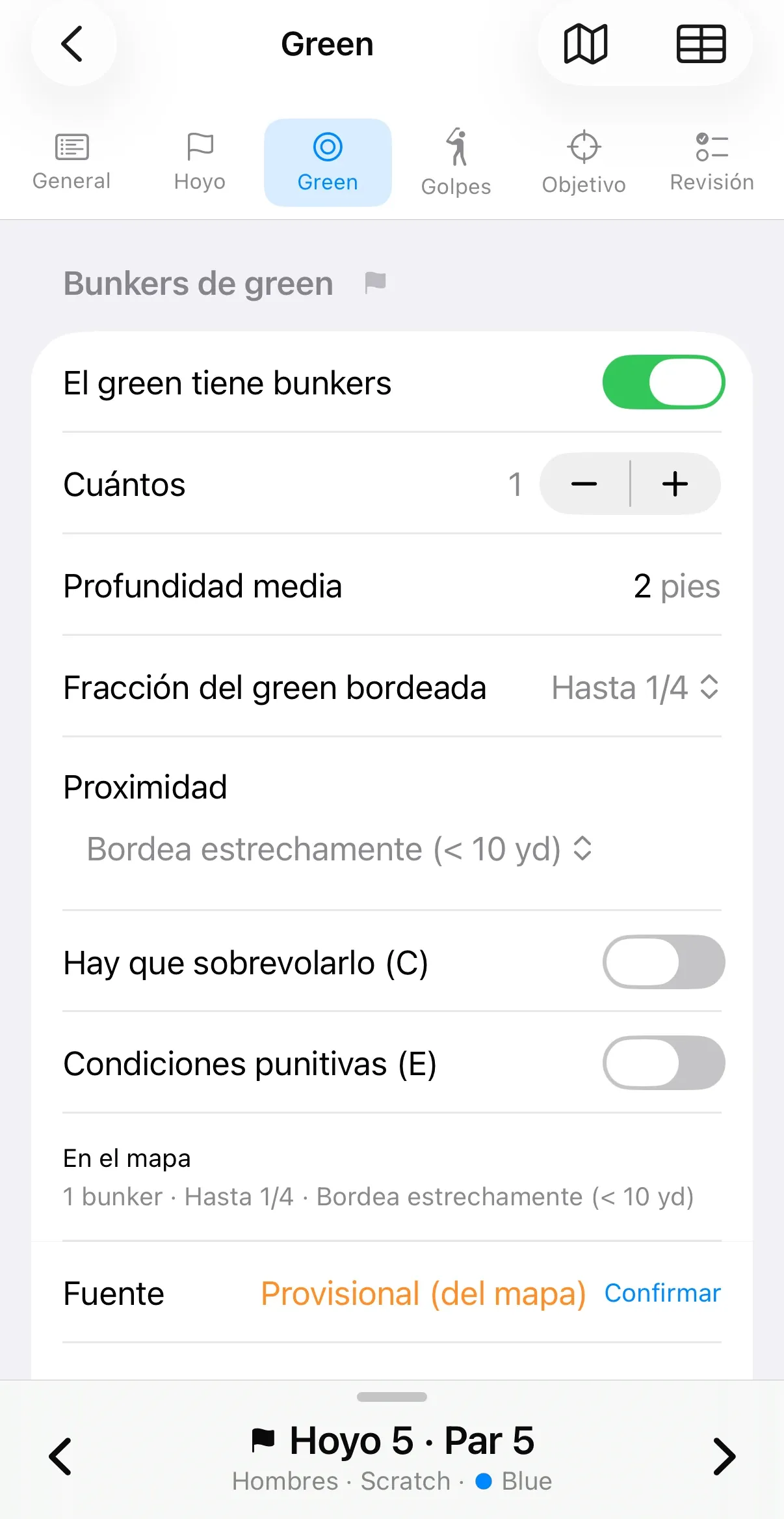
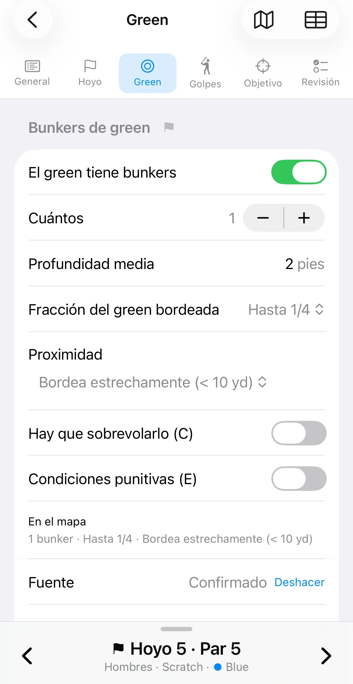
At the bunker, the rater confirms and completes
The app has already worked out everything around the bunker: how much of the green it borders and how far away it lies. Standing beside it, the rater measures the depth with the rod, makes the judgments only possible there, and confirms. The source row remembers which value came from the map and which the rater gave, and it lets the change be undone.
What is handed in
The form the team hands in
Everything measured on the map and confirmed on the course falls into its column of the USGA™ Form 1, scratch and bogey side by side. An experienced rater can run a quick check on this view itself, which the app fills in as the survey closes.
How far the computation goes
A computation engine built for golf works over the tracing. For each measurement it settles which elements come in: which bunker is in play for that shot, how far a lateral obstacle lies, how much has to be carried. What each obstacle is worth is decided by the rater standing in front of it, and the survey records who decided what.
What the computation settles
- Which bunkers are in play around the green, within 20 yards of the edge.
- How much of the green they closely border, under 10 yards away.
- How far each lateral obstacle lies, already placed in the band of the USGA™ table.
- How much has to be carried at each crossing, with the manual's 10-yard margin.
- Which obstacle is left out because it lies more than 50 yards away.
What the rater decides
- What percentage of the shot is in play.
- How deep a bunker is.
- Whether a carry counts as significant.
- Whether the conditions are extreme or punitive.
- How the ball bounces toward the obstacle.
- Where each point really is, with GPS.
- Which reading of the map to confirm, which to correct and which to measure again.
The survey keeps both things: the value that goes on the form and the rater's observation that produced it, the grade of a slope, the severity of the trees, why a bunker counted. For every value it also records where it came from, whether the map read it, whether the rater corrected it or confirmed it standing on the hole, and when. A point anchored on the ground with GPS is worth more than one traced by hand over the map. The software tells the two apart, and a team that rates the course again starts from there, deriving only what is new.
Things a rater may want to look at
How a green is traced, where the transition zone falls, how a carry is settled, and how the tee is changed.
-
One tap traces a green
With the AI tool active, the rater taps the green on the satellite image. The app recognizes the outline and leaves it as a polygon with handles. Then the bunkers, one by one, and in seconds the surroundings of the green are traced without a single vertex placed by hand. If it needs a correction, the rater can always make it by hand.
-
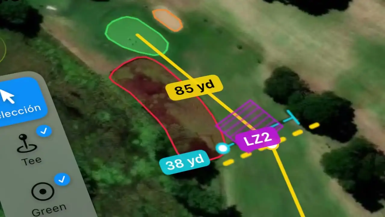
Where every shot lands, before anyone walks the fairway
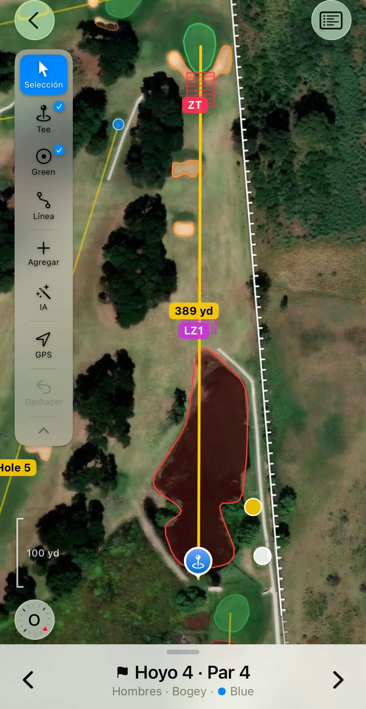
On this par 4 the play line crosses a lake. The app marks the landing zone of the tee shot on the line. Because the bogey player's approach falls short, it marks the transition zone in front of the green, where the manual puts it. The rater finds it already drawn on the hole.
-
The lake reaches the form already measured
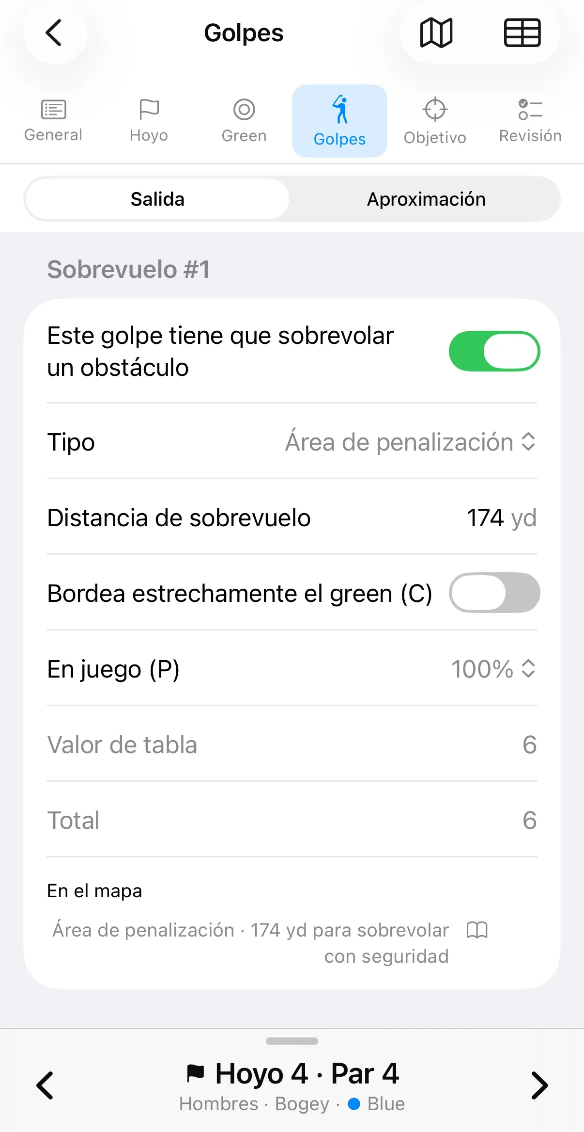
The same lake appears on the hole's shots tab as an obstacle to carry, with the distance already taken from the tracing. The rater sets the manual's adjustments with a tap, and the app settles the table value without anyone having to remember the row.
-
One panel changes hole, tee and player
A panel over the map changes the hole, the tee, the gender and the skill. The landing zones and the measurements are redone for that combination. The rater goes through every rating of a hole without leaving the map, and the green and the tee traced once serve all of them.
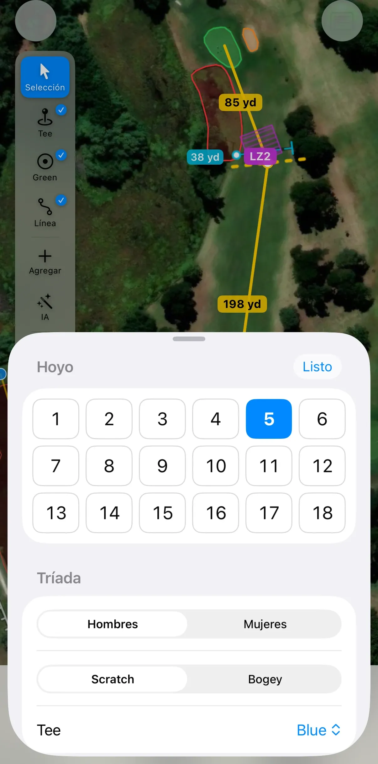
The app speaks Spanish and English. These captures are in Spanish, and the row names of the USGA™ form stay in English, as on the printed sheet.
Where the app is today
- In testing: it has been out on the course, and the waiting list is the invitation to the first open round.
- The app runs on iPhone™, in Spanish and in English. Android™ is on the roadmap.
- Designed to work without a signal.
- The USGA™ and the authorized association still issue the official rating of the course. The app simplifies the earlier steps, the ones the team hands them.
Who it is for
For the course rating teams of the authorized associations, the only bodies that may issue Course Rating and Slope Rating™ in their jurisdiction. The recommendation is to re-rate every 10 years, so it is exacting work that almost nobody does often.
Waiting list
Get the news from the work, and the invitation to the first round of open testing.